From south-east Queensland down as far as Sydney, the events of the recent “rain bomb” have raised so many issues. Apart from the appropriateness of disaster responses, warnings, and the like and, of course the role of climate change, there’s been that recurring question as to why so many of our cities and towns are located on flood plains.
Flood plain settlements go way back in history. At school we learnt of the importance of the fertile Nile delta, of the world’s longest river, with a basin that stretches into ten African countries, headed northwards through Egypt towards the Mediterranean. The challenges of juggling the benefits of flood-delivered silt fertility with the inevitable damage in times of flood.
Or yet the Indus River, rising in Tibet, fed principally by snow melt from the Himalayas, before heading in a south-westerly direction, through Pakistan to enter the Arab sea. Also heavily influenced by monsoon rain, massive flooding in 2010 led to a humanitarian disaster that killed between 1,200 to 2,200 people, destroyed some 1.6 million houses and left around 14 million people without homes.
Or Bangladesh, to the east of India, located on the floodplains of the Ganges delta and where severe flooding in 2010, 2017, and 2019 had major consequences, before all being eclipsed by the “unprecedented” floods of 2021 where it was reported that 75% of the country went underwater.
So while fertility has historically been the drawcard to chance it with the elements and make settlements on floodplains, that doesn’t adequately explain the situation in the just over two hundred years of white settlement in Australia.
Most of Australia’s cities are located along the coast line and adjacent to a significant river. Quite understandable really, as river estuaries provided both access to marine transport routes as well as well as shelter from rough weather.
Neither the flood fertility nor the transport benefits explain Gympie’s location however.
Gympie’s location was due to one thing… gold.
While Hector Holthouse (in “Gympie Gold”) correctly attributes the discovery of gold at Gympie to John Carne Bidwill in 1848, it was James Nash who is generally credited with it some nineteen years later in 1867.
The location of Nash’s find was not easy to reach, there was a rough track, not even suitable for a bullock team, but nonetheless thousands of hopeful gold seekers arrived, generally from Maryborough although later many would arrive via Tewantin.
Holthouse describes how, in late December (of 1867), the trees along the route from the Commissioner’s Camp to Nash’s gully were cut down and burnt and the track thus created was called Mary Street, and before it was even finished “ far-sighted men were building bark shanties and shops under the shade of the trees that still lined and overhung it.”
Thus Mary Street was born.
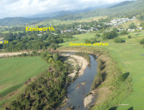
The wisdom of its location was experienced just over two years later, when, after a fortnight of rain in March 1870, the fledgling settlement of Gympie experienced its first flood (21.61metres). The water poured into hundreds of mineshafts, smashed flimsy bark dwellings and lifted more substantial wooden buildings from their stumps.
Five years later, the flooding was repeated and again buildings were inundated, smashed or carried downstream. Major mineshafts were modified to include floodgates to protect them from inundation from above and these proved adequate against yet another flood, in 1890 which peaked at 19.28 metres.
Then came the flood of 1893, the year when three cyclones would cross the Queensland coast and cause massive flooding in both the Brisbane and Mary rivers. Rain and torrential gales began in late January and Holthouse wrote that by early February the lower part of Mary Street and One Mile were flooded and the Mary was rising “about ten inches an hour”. Many buildings were submerged and no fewer than 120 houses were counted floating down the river.
The floodgates protecting the mineshafts failed as they had had been based to protect against flood heights experienced in 1870 and this flood being significantly higher simply poured into other shafts thought to have been out of harm’s way. Some of the gates exploded high into the air as flood water cascaded into the connecting shafts. An eye witness reported “a column of water being raised to a height of over 100 feet (30 metres) into the air”. Just under a fortnight later, the Mary experienced a second major flood (21.08 metres), a pattern oft repeated in the years since.
While no subsequent floods have surpassed the flood peak of that 1893 flood (25.45metres), many have given it a good nudge. A pair in 1898 both exceeded the 21 metre mark, but the following fifty years or so saw floods that only reached more modest proportions, perhaps engendering a sense of complacency as Mary Street moved on from the impermanence of bark shanties.
There was much speculation at the time of the 1999 flood as to whether it would surpass the one of 1955. It did, 21.95 metres as opposed to 21.44.
And then the “rain bomb” of this year that brought the Mary to a peak of 22.96 metres, “the largest in living memory”, eclipsed only by 1893.
How different would it have been if the location of that early Mary Street had been revisited after the 1870 flood, or at least after that of 1893.
But it’s more than just Mary Street. We have a notion of a river as being in the location we see it for what, perhaps 90% of the year, and view a flood as an unwelcome aberration, an unasked-for intrusion into our lives.
And yet nothing is more inevitable.
The flood plain is the river’s territory and every so often, when sufficient rain falls, we are powerfully reminded of that fact. It seems we’ve been somehow lulled in recent times by this “1 in a 100 year” terminology when some places have experienced three such floods in a decade.
If we’ve learnt anything from recent events (apart from improvements in disaster management, and the difficulty of moving things out of the flood plain), it has to be Councils not approving development there in the first place.
But will the memory of recent events recede just as surely as those murky brown waters have?
Article by Ian Mackay
Image 1955 – Atlantic Hotel – Cnr Monkland and Mary Streets


